Made the most of the sumptuous spread laid out for our delectation in the large breakfast room, and after filling up we took the short drive the Knysna Heads, here two dramatic sea cliffs create a lagoon which they protect from the worst of the pounding waves. The weather was dismal so we didn’t get much of a view, dramatic or otherwise, but we dutifully walked down to the shore because, well, we were there and that’s what you do.
 |
| A view from Knysna Heads, it looks more interesting that it was |
Apart from that, didn’t really see much else, most of the area was filled with gentrified suburbs, as is the way for coastal retreats, not that there was much to retreat from. After that we motored to Thesen Islands, which consist of a series of 19 man made islands linked by 21 arched bridges situated in the Knysna estuary. We took the road that connects it to the mainland and drove into what was a small version of Venice if Venice had been built by yuppies.
So after making use of a trendy coffee shop that had been highly recommended as the place to get a cup of coffee, as these sorts of places often are, I paid the rather generous bill (I was the one expected to be generous judging by the prices), left a tip so small it started to cross the no man’s land from gratuity to insult and let the silver splendour glide us from the boutique surrounds to our next port of call.
We were barrelling our way towards Tsitsikamma National Park by way of Plettenberg Bay, which we stopped at just to have a nosey around, it has some very nice beaches which we took time to have a gander at, but as a whole the place was definitely tourist central, extremely busy, what it must be like at the height of the season doesn’t bear thinking about.
We didn’t hang around for long and before we knew it had arrived at the National Park. The park as a whole stretches for 80 km along the coast and encompasses both marine and forest environments, it is Africa’s oldest and largest marine reserve, is one of the largest Marine Protected Areas in the world (the park boundary stretches 5 km out ocean side) and lastly, the word Tsitsikamma means ‘place of much water’. So there you go, your knowledge of the park is now complete.
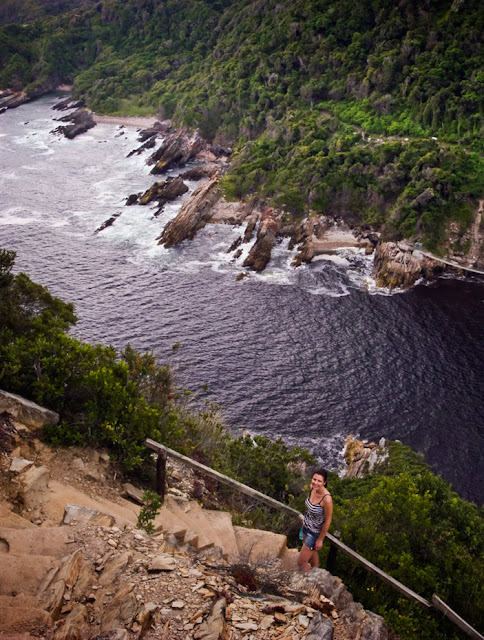
After paying the entrance fee we drove to Storms River Mouth to check out the information centre and to locate the start of a walk we quite fancied doing. But before we got stuck into that we couldn’t resist the short walk to see the suspension bridge, this arresting structure spans the mouth of the Storms River and affords an almost fantastical view of this majestic water way as it runs its course out from the interior through steep, densely vegetated cliffs, before it meets the ocean below.
 |
| Storms River Mouth |
Once across the bridge we saw a sign for a lookout point, this, obviously was too good an opportunity to miss, so we made our way up the trail for the short walk to the top. It turned out to be somewhat steeper than I had anticipated, and by the time I got to the summit I’d probably lost about 4 pints of water, but at least my t-shirt was well hydrated. I contemplated wringing it out for a bit of refreshment, but thought that might be taking things a bit far, any unwary sightseer might get a bit of a shock upon stumbling to the top in search of a sublime view only to be confronted with a grown man sucking feverishly on his own sweat soaked clothing. I made do with drinking my own urine instead. The view, as expected, was amazing though and it was well worth the effort.
 |
| View from the lookout. Note the look of disappointment at my choice of refreshment. |
After what should have been a minor diversion but had ended up almost knocking me out, we were now ready to tackle the walk we had originally planned to do. This walk was the beginning of the legendary Otter Trail, this 42km, 5 day trail is said to be one of the best in the world thanks to the scenery it offers. Needless to say we weren’t about to tackle this walk, I’d already downed most of my urine so my supplies were a bit low. Instead we were walking the 3 km waterfall walk, which sounded very agreeable.
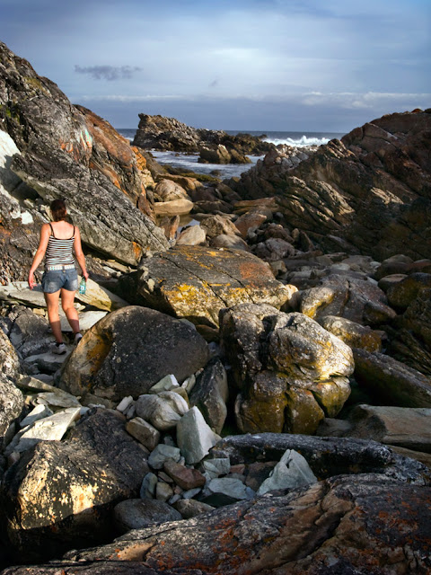
It started off much as expected, undulating pathways under the forest canopy that hugs the shoreline, we were hoping that this waterfall would yield a bit more in the way of water falling than the previous one we had done in Swellendam. Before long the path came out onto the shoreline itself and took us down across the outsized boulders and jutting rocks that lie between the sheer forested cliffs and pounding sea. Thankfully the trail is well marked with yellow paw prints so we could make our ungainly leaps and blunderous scramblings, safe in the knowledge that our cumbersome acrobatics were taking us in the right direction.
 |
| The waterfall |
It was slow progress to be sure, unfortunately my natural gazelle like nimbleness had improbably deserted me for the afternoon so I was making heavy work of the precarious terrain. Finally though we turned a corner and there was the waterfall. Despite the fact that the majority of the walk was along the shore, I had held the mistaken belief that the waterfall was actually in the forest, which had been troubling me somewhat as I could see no intention of the path leading inland, obviously this explained it. Well what a waterfall it was, an absolute beauty, quite easily the best waterfall falling into the sea I’ve ever seen.
So after taking a few pictures and having a bit of a rest we turned round and made the precipitous journey back to the car. It didn’t seem as bad on the way back, probably because we knew what it would be like, and I was feeling rather pleased with my sure footedness as I scooted from one boulder to another. It was about then that I heard someone behind me, so I moved out the way, and a man, dressed in shorts, t-shirt and trainers came running, yes running past me, not trotting, or jogging, or scampering, or loping, but full out sprinting, this was obviously his local run and he was getting a bit of late afternoon exercise. I looked at Sarah and she at me and, as one, we sighed and continued our awkward voyage back to base.
 |
| One of the more sedate stretches of the walk |
We got back just as the sun was beginning its decent towards the horizon, looking weary (Sarah) and startlingly bedraggled (me) but pleased we’d seen the waterfall. As we left the trail I looked back at the signpost and saw that it had helpfully mentioned the terrain was, and I quote, ‘uneven’. With an ironic smile I walked back to the car in good cheer and finished off the last of my urine.
After stopping at the café for a well deserved coffee we made out way back to the hotel, arriving after dark. Once a much required shower and change of clothes had been obtained we walked up the road to a restaurant we had passed earlier in the day and had a couple of pizzas, they were average at best, and didn’t taste of much. One of the very few meals that hasn’t been outstanding on the trip so far, which is pretty good going I think.

No comments:
Post a Comment